


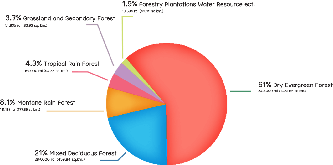
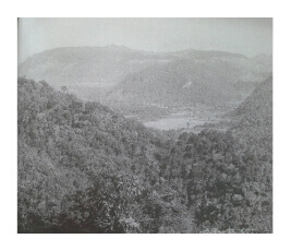
“Khao Yai Biodiversity” is the first national park in Thailand and has significance as a World Heritage Site and also as an ASEAN Heritage Park. It’s territory is 2,168 square kilometers, covering 4 provinces: Saraburi, Nakohn Ratchasima, Prachinburi, and Nakhon Nayok. Most of the forest in Khao Yai National Park consists of wide grassland and rich forests, comprising Dry Evergreen Forest, Mixed Deciduous Forest, Montane Rain Forest, Tropical Rain Forest and Secondary Forest which are home to a variety of fauna and flora.


Khao Yai is the watershed of Lamtakong, the river that nourishes the people of Nakhon Ratchasima.
“Khao Yai is the watershed of Lamtakong,” the river that nourishes the people of Nakhon Ratchasima. “Lamtakomg River” or “Lamtakong” originates between Khao Fa Pah in Pak Chong district, Nakhon Ratchasima Province, and Khao Fa Lamee in Muang district, Nakhon Nayok Province, which is part of Dong Phaya Yen Range and Sankamphaeng Range in Khao Yai National Park. Lamtakong River Basin is 200–300 meters above mean sea level and has an area of 3,874 square kilometers, covering 6 districts of Nakhon Ratchasima Province. The upstream of Lamtakong also serves as a boundary line between Nakhon Ratchasima Province and Nakhon Nayok Province. Flowing northwards through Pak Chong District, then eastwards through Sikhio District, Sung Noen, Kham Thale So, and Muang Nakhon Ratchasima District, it’s confluence with the Mun River at Tha Chang Subdistrict, Chaleom Phra Kiat District, Nakhon Ratchasima. With a total length of 243 kilometers, Lamtakong has a 3,518-square-kilometer alluvial area and a natural runoff of around 510 million cubic meters per year.

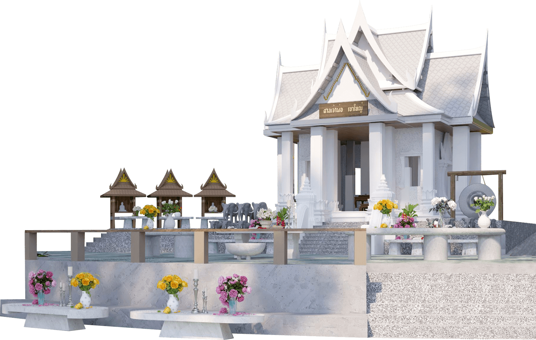
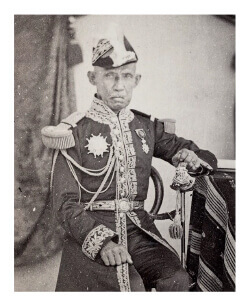
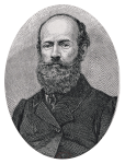
A legend has it that Chao Por Khao Yai was Mr. Jang Nisaisataya, or “Palad Jang.” Born in Nakhon Nayak Province, he served as an Army Comptroller, in charge of Burapa Command, and a seasoned veteran on the battlefield against neighbouring countries. He was a man of dignified personality, a warrior, and he was also considerate and generous. Every time the battle ended, he often visited his subordinates and friends who fought side by side with him on the battlefield.
After retirement, he heard that his old subordinates had become bandits in the Khao Yai forest and cleared the land. Thus, he cooperated with the government to persuade and suppress the criminals. Due to his expertise in using guns on horseback and his familiarity with the geography of this area, he successfully destroyed the thieves' den, became famous, and earned the respect of the villagers around Khao Yai. Palad Chang died of malaria at the age of 75. The villagers therefore united in setting up a small shrine under the big Krabok tree at the foothill near Wat Nong Iam School, Nakhon Nayok Province. The villagers call this shrine “Por Palad Jang Shrine.”
Did you know... When was the Chao Por Shrine built?
Thanarat Road

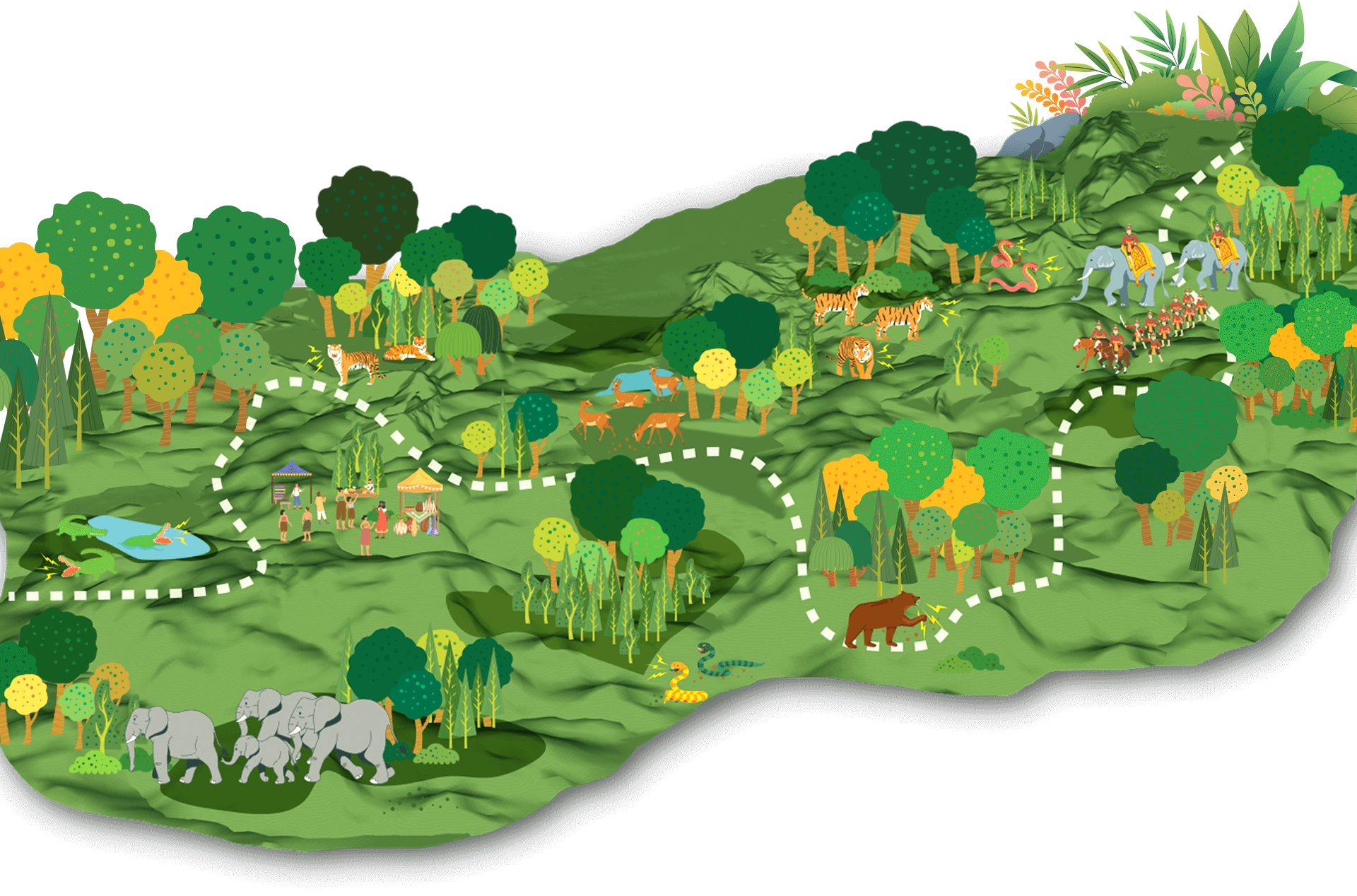


This land was called Dong Sam Sao, the border between the Ayutthaya Kingdom, the Lan Xang Kingdom, and the Khmer Empire.
During the reign of King Ramathibodi I (King U Thong), the first king of the Ayutthaya Kingdom, he sent a royal message to King Fa Ngum. First King of the Lan Xang Kingdom to maintain royal goodwill when King Fa Ngum was to expand his territory down to the Chao Phraya River basin, state: “If both of us've been brothers since Khun Borom, you want to claim more land. You should draw only the territory of Dong Sam Sao (Dong Phaya Fai) as far as Phu Phaya Pho (Phu Phaya Por-Chaiyaphum province) and the territory of Mueang Nakhon Thai (Muang Nakhon Thai-Phitsanulok province) as yours. One, I will gift you sugarcane juice and sugar. One, my daughter's, Nang Kaew Yodfa. When she’s growing up, I'll send her to take care of the bed and pillow for your majesty.” (Lao History Book: Sila Viravong (Maha)).

Legends that have been told about the Dong Phaya Fai forest or Dong Phraya Fai are that it’s the rainforest infested with jungle fever, dangerous beasts, and mystical mysteries that caused many deaths in the Dong Phaya Fai forest. There is a saying, “If you have to walk through Dong Phaya Fai, prepare a clay pot for your own bones.”
The dense rainforest and rugged and rough terrain make this forrest difficult to travel through, and many stories have been told about the dangers that will befall those who set foot in this terrifying forest.
Jungle fever: Jungle fever is considered the most common cause of illness and death among those traveling through Dong Phaya Fai. As a result of “Malaria” which is carried by the Anopheles mosquito. The patient will chills but a body will be as hot as if on fire. Various organ functions will deteriorate, resulting in loss of consciousness, pain, pulmonary edema, kidney failure, and eventually death.
Beasts: This forest is infested with ferocious beasts. Even at night when camping in the forest, you have to build an bonfire and guard it all night to watch out for dangerous animals and keep adding firewood, since if the fire burns out, the camp might become the target of those beasts.
Mysterious mystery: The mysteries of this forest have long been told. Including stories of the guardian spirits of the forest, sylvan, ghosts, and weretigers. Even now, when the forest is less fearful, the mystical story of Dong Phaya Fai continued to be told until today.
No matter how many frightening stories there are about Dong Phaya Fai, it is still an extremely important route. Be it military marches or merchant caravans between communities from the Chao Phraya Basin (central region) and the Korat plateau (northern region), Although there are many routes, including the route across the San Kamphaeng mountain range towards Muang Chai Badan, passing through Dong Phaya Klang crossing, and the route across the Phanom Dong Rak mountain range from Prachinburi city, passing through Sakaerat crossing, Bu Khanun crossing, and Tako crossing, the route through Dong Phaya Fai is the most popular due to the shortest distance, even though it’s the most dangerous route.

 In 1856, His Majesty King Pinklao went to Nakhon Ratchasima to do the royal duty of exploring the establishment of Nakhon Ratchasima as another capital of Siam. His Majesty thought that Dong Phaya Fai has a cool climate all year round and never a time with high temperatures; hence, it should not be called Phraya Fai to intimidate people. Therefore, King Pinkloa reported to His Majesty King Mongkut to ask his permission to change the name to "Dong Phraya Yen" (travel along the railway: the writing of His Royal Highness Prince Damrong Rajanubhab).
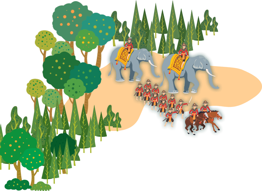

 During the Ayutthaya period, Dong Phaya Fai was an important route for military marching. In the reign of King Borommarachathirat II (Chao Sam Phraya) in 1431, the Ayutthaya army used this route to expand royal power and suppress the influence of the Cambodian kingdom. In 1586, King Naresuan the Great also marched his army through Dong Phaya Fai to attack Lovek, the second capitol city of Cambodia. Later in 1593, he marched his army to subdue Phraya Lovek, King of the Cambodia Kingdom, once again.
In 1768, King Taksin the Great marched his army of Thonburi through Dong Phaya Fai to attack Nakhon Ratchasima city to suppress the riots of Chao Phimai's congregation, when Chao Phimai wanted to be independent after Ayutthaya fell for the second time.
Also, during the suppression of the Vientiane Rebellion in 1826, His Majesty King Nangklao, King Rama III, ordered Somdej Pra Borworrarajjoa Maha Sakdiphonseph, the crown prince, to lead the army to march through Dong Phaya Fai to join with the vanguard and the rear-guard armies at Nakhon Ratchasima before successfully attacking and seizing Vientiane.
“Khao Dong Phaya Fai is a mountain range that is the dam of the country. It has been said since ancient times that Nakhon Ratchasima platuae is seven sugar palm trees higher than the Bangkok area. When a map was made, it appeared that the Nakhon Ratchasima city area was 185 meters above sea level. It doesn't seem too far from the ancient words.” (Travel along the railway; HRH Damrong Rajanupab)
“Here I stood at the gate to hell. This is an expression that Lao and Siamese people talk about in this dense rainforest. Mysterious creatures from the realm of the dead, sleeping under the thick shade of the trees, were there’re remains of a poor traveler.” (Henri Mouhot, French naturalist and explorer)

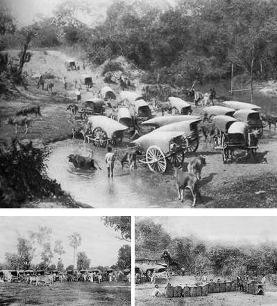
Dong Phaya Fai is also an important trade route for "Nai Hoi, or Cowboy." When demand for cattle and buffaloes in the central region increases due to rice farming for export, create an opportunity for a career in the cattle-buffalo trade. By buying cattle and buffaloes and selling them to various villages and communities, or by herding them to be sold at cattle and buffalo markets at a trade destination.
Cattle and buffalo had been herded by foot and used oxen carts to carry all their belongings. They will travel from various communities to Nakhon Ratchasima, through Dong Phaya Fai, before descending to the plains in Saraburi Province.


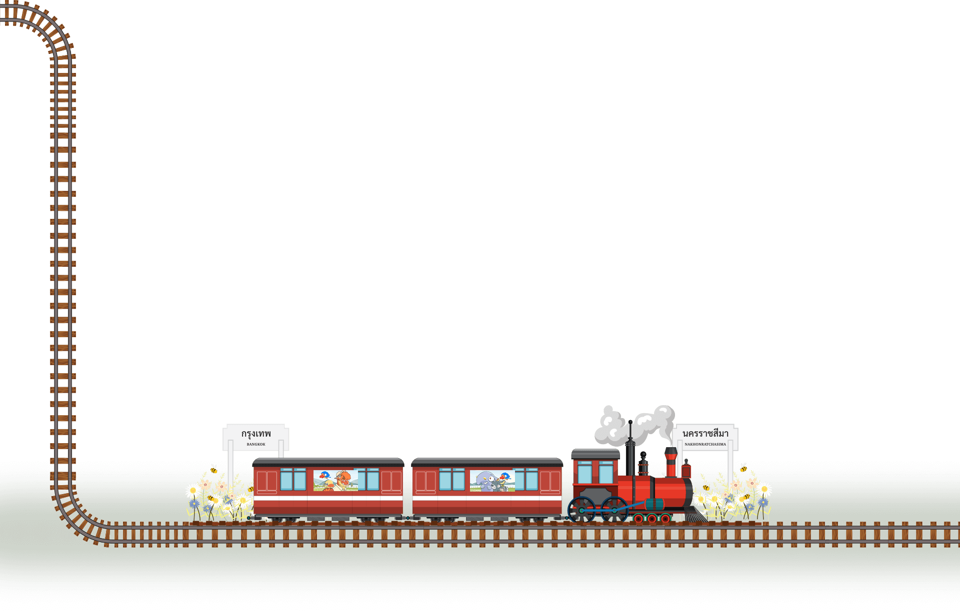


Nakhon Ratchasima It has been an important outpost city since the Ayutthaya period until the Rattanakosin period for the administration of the eastern royal territory. The city was also a center market for exchanging goods from the eastern provinces in the Mekong Basin and products from Bangkok. Thus, this is an important reason behind the construction of the railway from Bangkok to Nakhon Ratchasima as the first railway line in the Siamese kingdom.
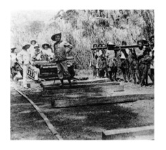
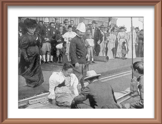
In 1890, His Majesty King Chulalongkorn, King Rama V, ordered the establishment of the Railway Department under the Ministry of Public Works and opened a bid to build the Bangkok-Nakhon Ratchasima railway line. Mr. G. Moore Campbell was hired to build the railroad. His Majesty graciously presided over the auspicious ceremony for the construction of the railway at the Bangkok Station on March 9th, 1891.
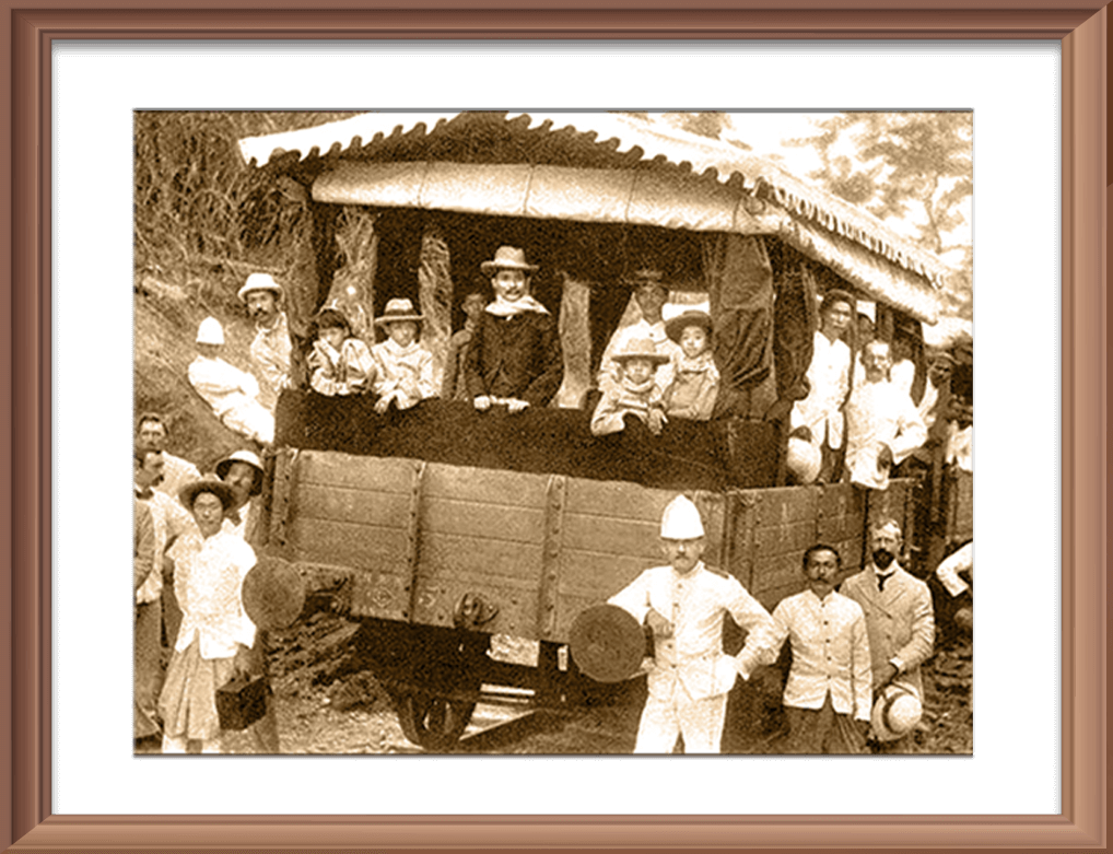
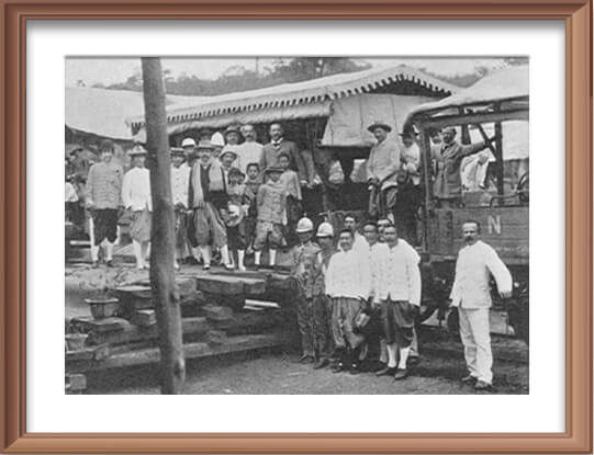
The first phase of railway construction carried out smoothly until 1895, when construction began to encounter problems during the construction through Dong Phaya Fai. Engineers and workers were sick of jungle fever; many died. His Majesty King Chulalongkorn and Her Majesty Queen Saovabha Phongsri travel by train to the construction site to observe and perform a ceremony to worship the Guardian Spirit of the Forest on November 14th, 1895, in the hope that the construction of the railway would proceed smoothly. His majesty graciously advised the Railway Department to continue construction to Nakhon Ratchasima until completion, a total distance of 265 kilometers, for a cost of 17,585,000 baht.
His Majesty also graciously ordered the planting of Eucalyptus trees to prevent jungle fever (Malaria) on either side of the railway line, as per the advice of Western doctors. This medicinal plant came into Siam during this period of time.
On December 21th, 1900, His Majesty King Chulalongkorn and Her Majesty Queen Saovabha Phongsri presided over the opening of the train service from Bangkok to Nakhon Ratchasima Station.
When the railway was completed, His Majesty King Rama VI, when he held the title of Crown Prince, Crown Prince Maha Vajiravudh of Siam, visited Dong Phaya Fai and other important places in the Nakhon Ratchasima city area. At that time, a train from Bangkok to Nakhon Ratchasima Station takes approximately 10 hours.
but they were all blown past the arid land. The solution lies on
how to make those clouds fall as rain in the locality”
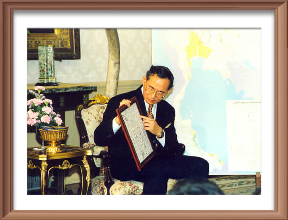
Between November 2nd and 20th, 1955, His Majesty King Bhumibol Adulyadej the Great, King Rama IX, visited the people in the arid and remote areas in the northeastern region. On November 15th, 1955, while His Majesty was traveling through the Phu Phan Mountain range, he noticed that there was a certain amount of cloud covered over the area but was unable to gather enough to precipitate rain, even though it's during the rainy season. That caused the people to suffer; farmers are in dire need of water for consumption and agriculture. Therefore, His Majesty researched in the field of meteorology and weather modification to make rain to alleviate drought and provide assistance to the people. His Majesty graciously gave the royal initiative project “Royal Rain” (Artificial rain) and gave the concept of "Make clouds coalesce and fall as rain." Then conduct the actual flight experiment.
On July 1st and 2nd, 1969, the Royal Rainmaking Operation selected Khao Yai National Park, Pak Chong, Nakhon Ratchasima as the first experimental areas in Thailand and received confirmed reports from the local people that there's actually rain on the experimental area in Khao Yai National Park. This is an indication that forcing clouds to produce rain is possible.
The Royal Rainmaking Project was registered under the invention patent “Modifying the weather to make rain” on November 29th, 2002, and the Cabinet passed a resolution to honour His Majesty King Bhumibol Adulyadej the Great, King Rama IX, as the "Father of Royal Rainmaking" and designated November 14th of every year as a Father of Royal Rainmaking Day.


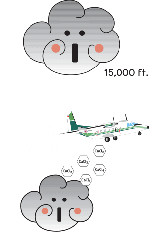
by dispersing Sodium Chloride (NaCl)
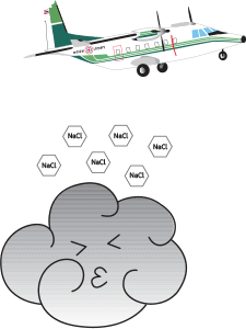
to make the clouds grow bigger.


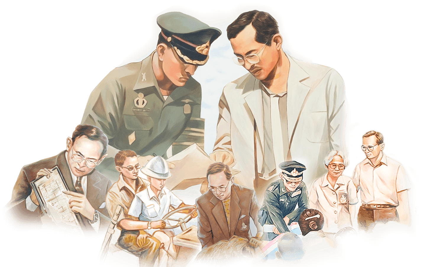

From the first royal command of His Majesty King Maha Vajiralongkorn, King Rama X, on May 4th, 2019, on the occasion of his coronation ceremony in the year 2019, reflected his royal aspirations and the determination of His Majesty's heart to continue, preserve, and build upon the royal aspirations of His Majesty Bhumibol Adulyadej the Great, King Rama IX, for the benefit and happiness of the people.


โรงเรียนบ้านปรางคล้า ต.หมูสี
อ.ปากช่อง จังหวัดนครราชสีมา 30450